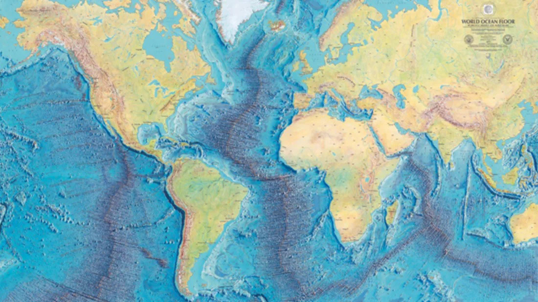
If you were to ask someone where the largest mountains in the world are, it’s no surprise where that person’s mind might go: Mt. Everest, for instance, is what many understand as the world’s tallest mountain. However, if we are discussing the largest stretch of mountain range, we need to look to the deepest, darkest recesses of the world’s oceans.
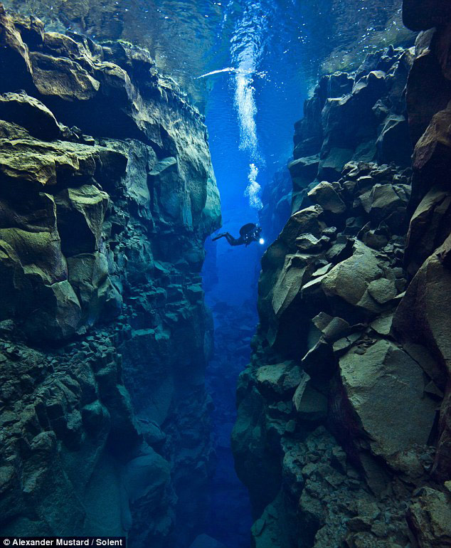
Capturing these photos between the North American and Eurasian plates near Iceland required a nearly 80-foot dive by photographers. The area is riddled with faults, valleys, volcanoes and hot springs, caused by the plates pulling apart at about one inch per year.
Photography by Alexander Mustard
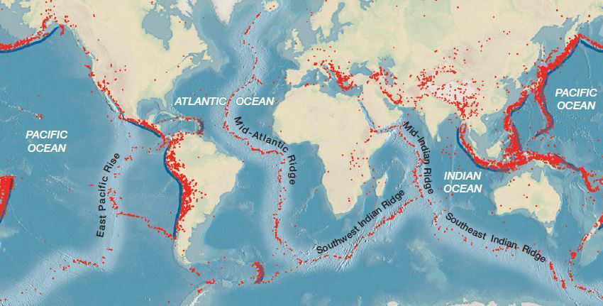
If you’ve ever been lucky enough to visit the Andes, Rockies or Himalayas, you’ll understand what a breathtaking and expansive sight they are. What is even more impressive is the fact that, if you combined all three of those mountain ranges, they’d still be four times shorter than the planet’s longest mountain range, the Mid-Ocean Ridge. The Ridge begins in the Arctic Ocean, through the Atlantic, past Africa, Asia, and Australia, and across the Pacific before ending in the west coast of North America: winding around the globe like the seams of a baseball. Spanning 40,389 miles around the globe, long enough to circle the moon over six times, this mountain range is one of our planet’s most obscure but vital features.
The Mid-Ocean Ridge system was created and expanded through tectonic activity, volcanism occurring at Earth’s spreading plates under the ocean. As the Earth’s tectonic plates slowly move apart, magma bubbles up to fill the gaps in volcanic eruptions, creating ocean crust and sheeted dykes. If ridge expeditions were not so challenging, we would see much more of the alien landscape that is the Mid-Ocean Ridge: giant fields of gushing hot springs that shed tons of minerals into the ocean water, eruptions slowly building into mounds and towers.
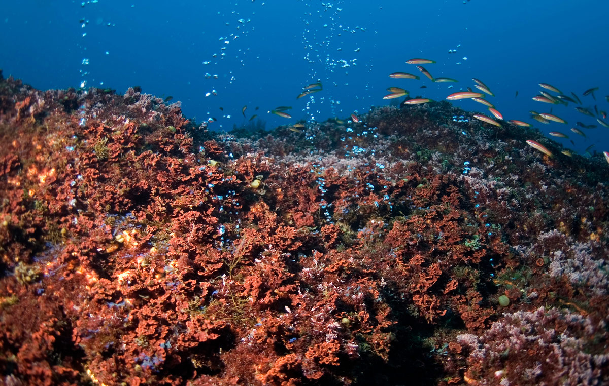
Hydrothermal vents at Dom João De Castro in the Azores. They are unusually shallow and their mineral deposits support unique communities of organisms often with special properties of interest for scientists and researchers.
Photography by Gavin Newman | Credit: © Greenpeace
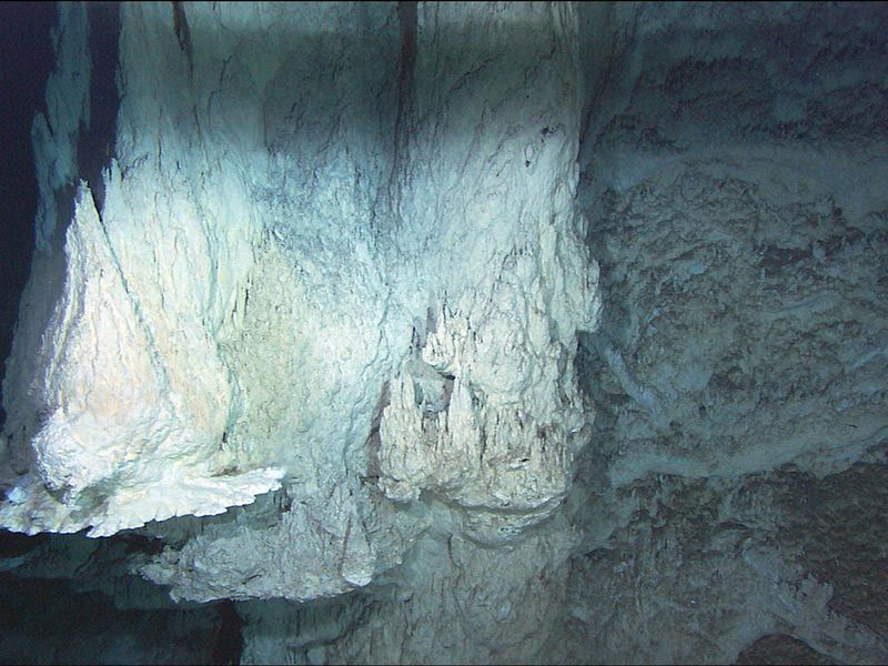
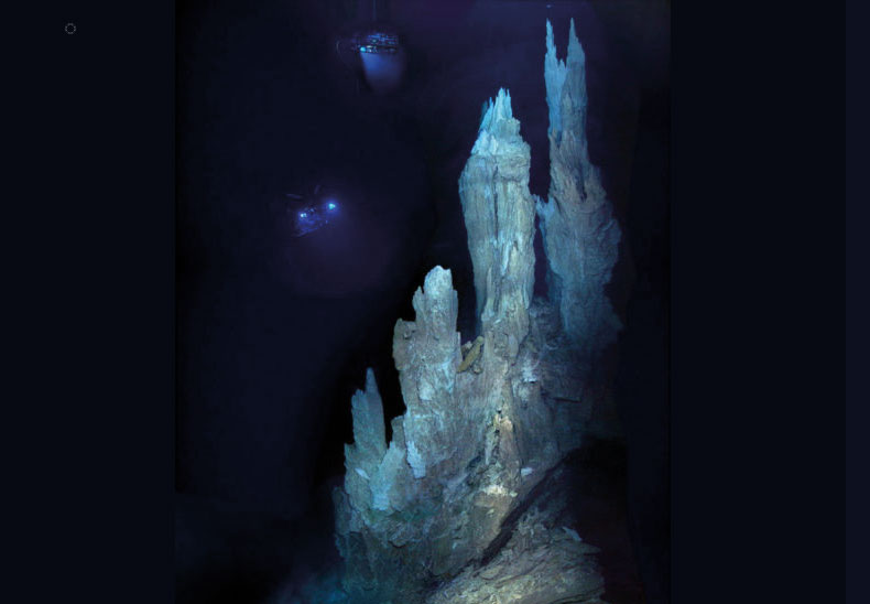
In these extreme conditions, there is even a Lost City of sorts: Lost City Hydrothermal Field is an area of marine hydrothermal vents soaring hundreds of feet high into the Atlantic Ocean, resembling sunken towers, spanning the area of a city block and towering between 30 and 200 feet tall. Some towers in this city are so large that they have their own landmark names, like Poseidon comprised of four individual towers that soar several stories high. This colony of marine alkaline hydrothermal vents is located on the Atlantis Massif at the intersection between the Mid-Atlantic Ridge and the Atlantis Transform Fault, as one of the most extreme ecosystems on the planet. What appears to be an abandoned metropolis is actually a remarkable submarine ecosystem teeming with microscopic life, in which geological, chemical, and biological processes are intimately interlinked. The microorganisms at Lost City have adapted to this extreme environment and live off of the gases and heat released from the rock. This vent system is therefore a remarkable biotope and one of the most important deep-sea scientific sites in the world. The Lost City is considered a World Heritage Site, albeit one that is only open to viewing by remotely-controlled robotics.
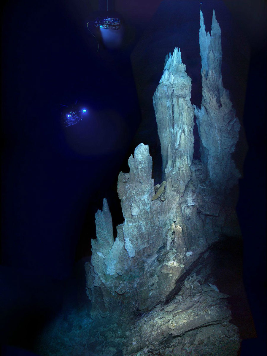
Carbonate chimneys of the Lost City hydrothermal field imaged during a 2005 expedition to the hydrothermal vent system by a remotely operated vehicle named Hercules.
The Mid-ocean ridge is growing on the borders of every ocean, and though about 90% of the Mid-ocean ridge is submerged underwater, in some places it rises above ground. The Ridge forms a set of volcanic islands of varying size, running the length of the Atlantic Ocean, which include Iceland, Azores, and more.
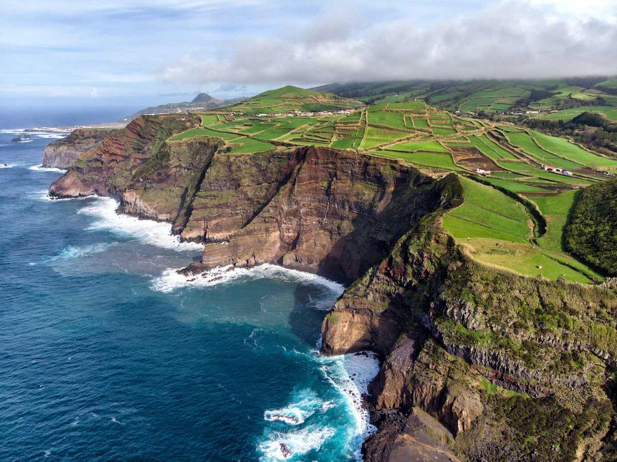
The ocean cliffs of the Azores, at a popular elevation for whale watching.
The Azores, a remote nine-island archipelago off the coast of Portugal, is an eden whose unforgettable landscapes, natural geothermal hot springs, and teeming biodiversity were sculpted by spreading plate tectonics. Once underdeveloped, the Azores is poised to be Europe’s hottest island escape, dotted with Portuguese colonial architecture as well as the fine food and wines of Portugal. The famed Azorean white wines, fresh seafood, and geothermal cooking are all long-revered island traditions. But what makes the Azores archipelago the “Hawaii of the Atlantic” is its location near the triple intersection of the Eurasian, American and African plates on the Azores Plateau, which is a thick and irregular area of oceanic crust in the middle of the Atlantic. The spreading rift at the centre of the Azores, called Terceira rift, formed around 36 million years ago, and continues to migrate southward at 2 to 4mm per year.
Several extinct volcanoes make up some of the most spectacular landscapes in the Azores. Bocas de Fogo is one example, which translates to “Mouths of Fire”: the last recorded eruption in May and June of 1808 caused major destruction to the island but produced a massive basalt field of volcanic rock and incredible crater. Volcanic landscape of Pico mountain is dotted with fantastic vineyards and surrounds the highest point in all of Portugal. Lush green flora and fauna, and deep oceanic blues are the perfect contrast to the soaring volcanic landscape of Pico mountain.
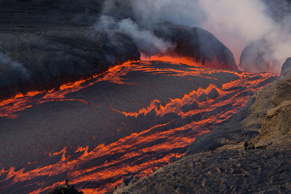
A cascade of lava flows from a fissure vent at Fogo during an infamous erutpion from 30 November to 3 December 2014.
“The island is composed of a complex large andesitic-to-trachytic stratovolcano that contains a 2-km-wide summit caldera. Thick deposits of trachytic airfall pumice, pyroclastic flows, and lahars related to formation of the caldera blanket the island.” – VolcanoDiscovery
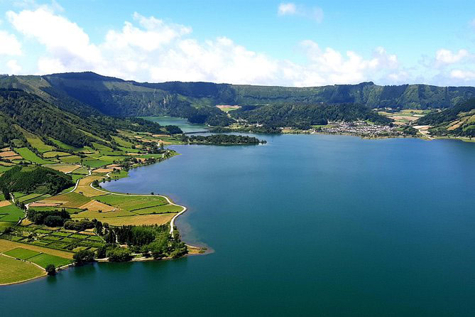
The Sete Cidades volcano, or Seven Cities volcano, sits at the eastern end of the spreading Terceira rift axis. This stratovolcanic complex is unique for its geological variety: several volcanic cones, lava domes, and flow deposits can be discovered throughout the volcano complex. However, the most stunning feature is a pair of crater lakes, one green and blue. Local legend dictates that the two lakes were created from the tears of two lovers, a princess and a shepherd: their respective pools of tears took on the colors of their eyes. The Azores owes its majestic natural beauty to its location on top of major global faults, rifts and plates, allowing them to develop a rich geography unlike anywhere else on the planet.
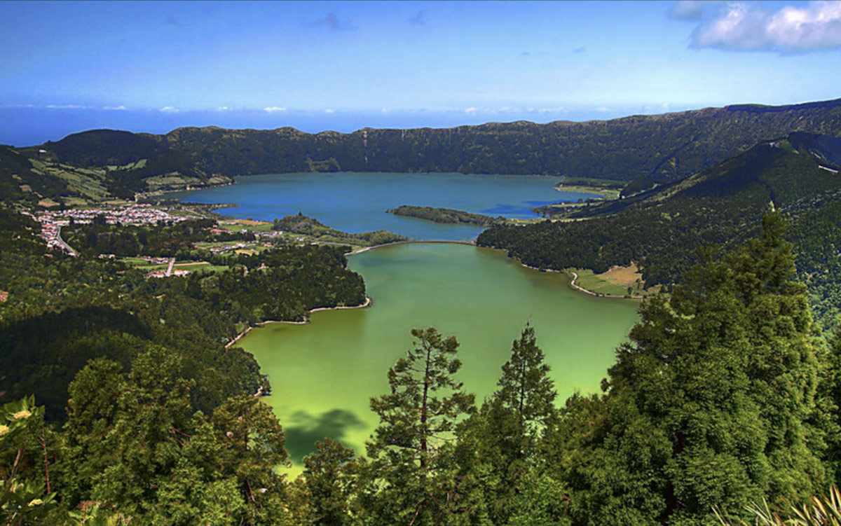
Although the Lagoa das Sete Cidades is one lake, most refer to it as two separate bodies: Lagoa Verde and Lagoa Azul. Literally, the Green Lake and the Blue Lake (respectively), they are so named because each side of the lake reflects the sunlight in different colors.
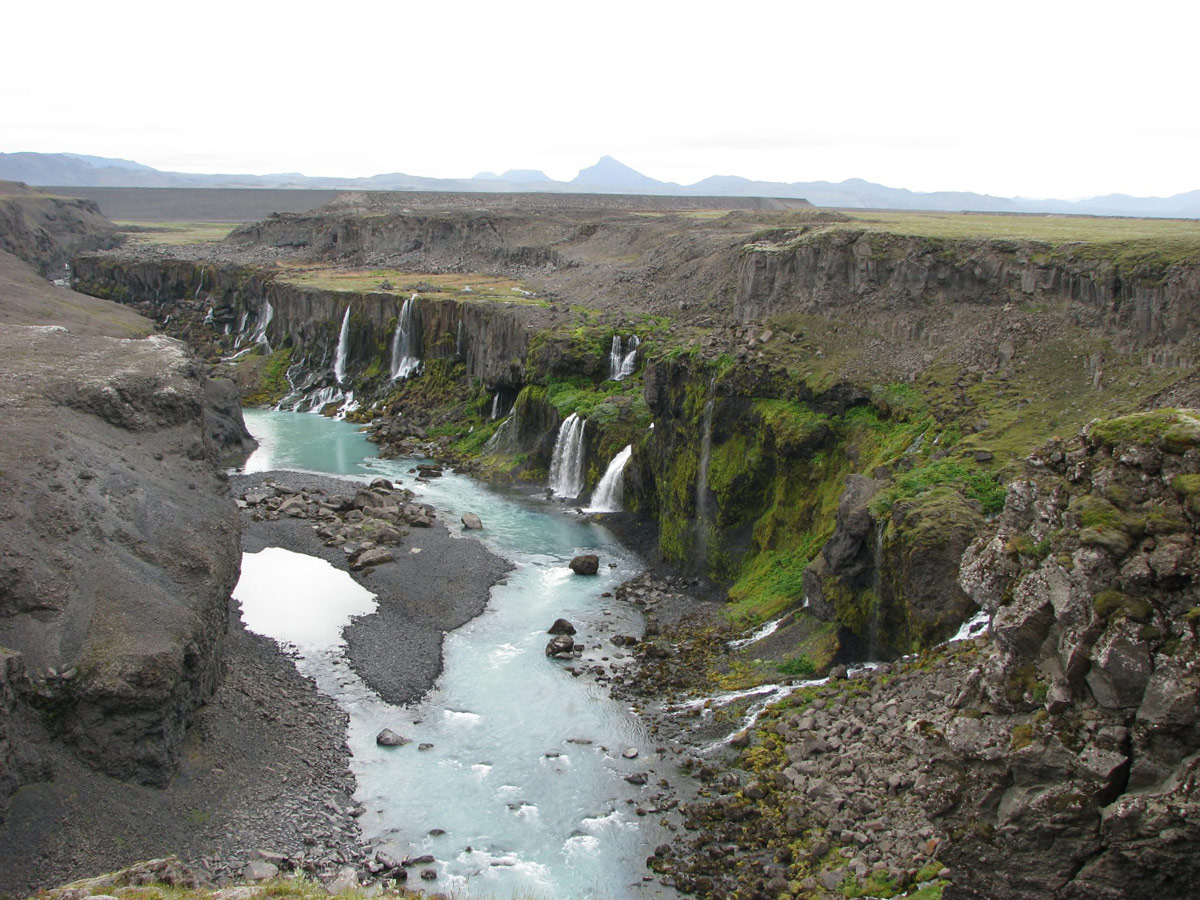
Iceland, the land of ice and fire, is a true paradise for volcanologists. In few places on earth, geology and human history are so closely connected to volcanism as on Iceland. The island owes its existence to a large volcanic hot spot sitting on a mid–oceanic ridge, a unique setting.
For many, Iceland is a wondrous, wholly unique body of land, rendering it almost otherworldly in the mind of much of the world. Due to the massive success of Game of Thrones, the sprawling landscapes have taken root in the show’s viewers, whether they’re familiar with the real world filming locations or not. So whether you know Iceland by its given name, or as the land beyond the Wall, North of North in Westeros, there are incredible geological sights that should inspire you to see these panoramas for yourself.
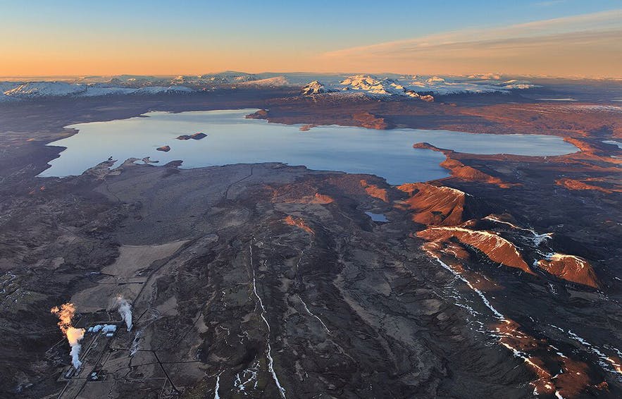
Þingvellir is a historic national park and one of the most visited sites in Iceland, as one of the most recognizable Icelandic locations in Game of Thrones.
In the grand scheme of Earth’s timeline, Iceland is a relatively young geological formation: the island of Iceland was formed from volcanic activity, triggered by tectonic plates pulling apart, allowing magma to flow upwards, forming the impressive landmass. In fact, tectonic plates can be thanked for many of the incredible sights Iceland has to offer. For one, this is one of the few places where one can witness tectonic activity up close, and even see a mid-ocean ridge on land. Normally you’d need to be a person of James Cameron caliber (including owning a submarine capable of incredibly deep dives like the acclaimed director) to have the privilege of seeing such normally submersed wonders of nature.
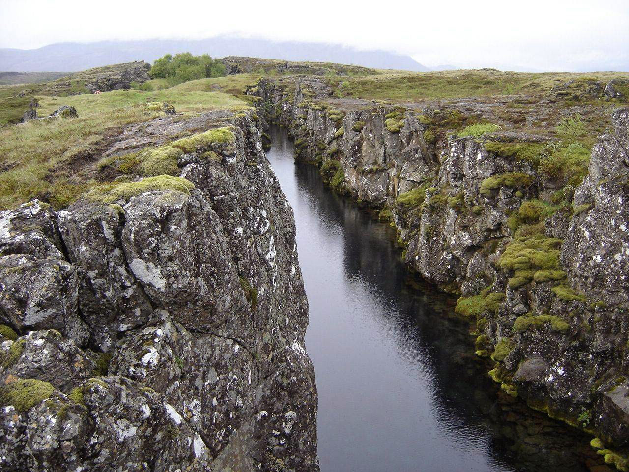
The park sits in a rift valley caused by the separation of 2 tectonic plates, with rocky cliffs and fissures like the huge Almannagjá fault.
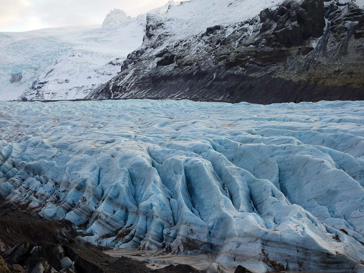
Svínafellsjökull, a glacial lagoon and outlet of Vatnajökull, the largest ice cap in Europe. It is one of Iceland’s most popular places for glacier hiking and mountainous views.
Furthermore, the volcanic activity can be thanked for a geological phenomena that can be seen only in a select few places of the world, like the mythical Giant’s Causeway in Ireland, but also in Iceland. Of course, these are the curious and staggering natural occurrences of basalt columns, hexagonal stone pillars that rise from the ground, structures that without scientific understanding would be attributed to ancient civilizations’ advanced, lost technology or even aliens if you’re a fan of the History Channel. These columns are formed due to their unique composition of iron and magnesium rich basalt, mixed in with magma and rapidly cooled. This change in temperature triggers a change in chemical composition that results in its geometric shape. These basalt wonders can be observed at locales such as Svartifoss or Aldeyjarfoss, where one can witness the basalt columns in concert with another famous feature of Iceland, beautiful waterfalls. These are simply unmissable locations if one is ever in Iceland. Beyond this, there are numerous beaches and cliffs, where one can bear witness to these logic-defying occurrences. If that isn’t enough, there are countless geysers, hot springs, and active volcanism to witness to fully appreciate the power of natural forces in Iceland.
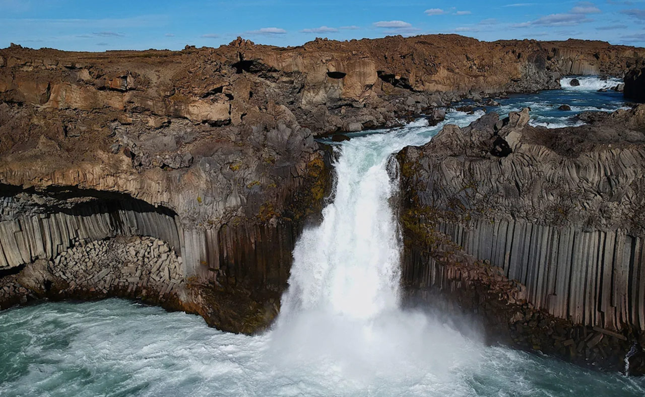
Iceland boasts more than 10,000 waterfalls, like Gullfoss, Goðafoss, and Dettifoss just to name afew. However, one of the most spectacular is Aldeyjarfoss Waterfall (pictured): a hidden natural gem unspoilt by tourists.
Thankfully, due to Iceland’s relatively small size, it’s also entirely possible to rent a car and cover an incredible amount of ground in however much time you happen to have on your travels. Doing such will allow you to see exactly what you want, for as long or as short as you want. This is undoubtedly the way to see the astounding sights of Iceland.
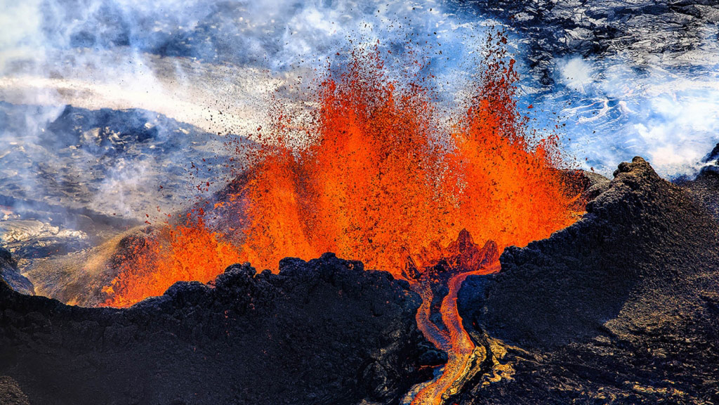
The Holuhraun lava field, located just north of the Vatnajokull ice cap in the Icelandic Highlands, was created by fissure eruptions.
“In few places on earth, geology and human history are so closely connected to volcanism as on Iceland. The plate boundary between the American and Eurasian tectonic plates crosses Iceland from south to North and the spreading process can be directly measured and observed on land.” – VolcanoDiscovery
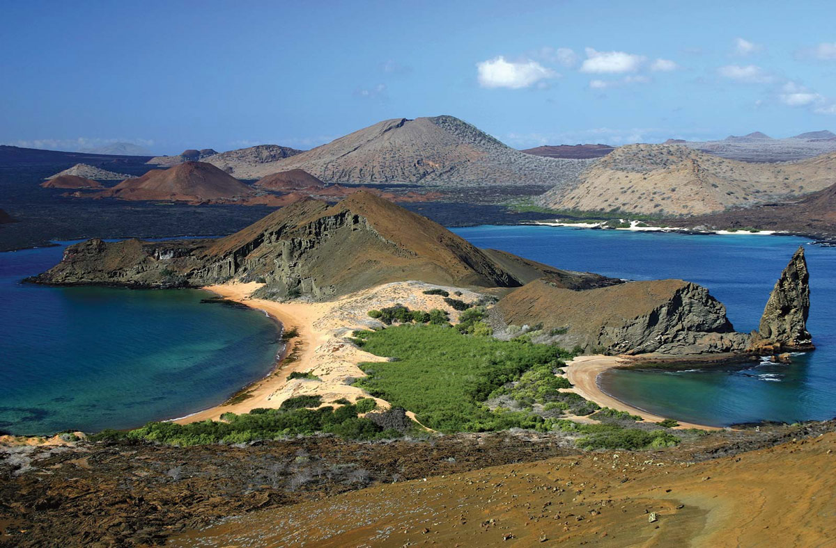
Aerial view of Bartolomé Island, a volcanic islet and one of the “younger” islands in the Galápagos archipelago.
Like Iceland, the Galapagos were born from volcanic activity resulting from shifting tectonic plates. In this case, it’s the Nazca tectonic plate, constantly in motion over the Galapagos hot spot, leading to the chain of islands we know as the cradle of evolutionary theory. The islands have a distinct conical shape, owed to and characteristic of their volcanic origins. In fact, all but the largest island, Isabela, has a large volcano. Due to the nature of volcanism, some of these islands, despite their several hundred thousand years of age, are still growing.
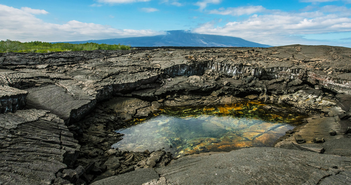
The Punta Espinoza on Fernandina Island in the Galapagos, host to diverse wildlife and spectacular volcanic rock formations.
These origins make the Galapagos a must-visit locale for a holiday, to witness the creatures that influenced our modern understanding of evolutionary science and to witness several different kinds of volcanoes and lava flows. The Galapagos hosts two types of volcanoes, and their two types of lava flows are must-see geological marvels. The volcanoes are stratified in the west and east, with those in the west being large volcanoes with deep calderas, and those in the east being shield volcanoes with gentle slopes and low viscosity lava. The two types of lava flows are A’a, sharp and brittle, and Pahoehoe, smooth and ropy. Any Galapagos tour worth its salt will allow you to bear witness to both beautiful types of lava flows. Furthermore, there are extensive lava tunnels and tubes to explore. The Galapagos have an incredible concentration of geological phenomena, mind-bending in scale and complexity.
“The Galapagos Islands in the western Pacific are formed one of the most active hot spots of the world and are similar to the Hawaiian volcanoes. Basaltic eruptions occur every few years.” – VolcanoDiscovery
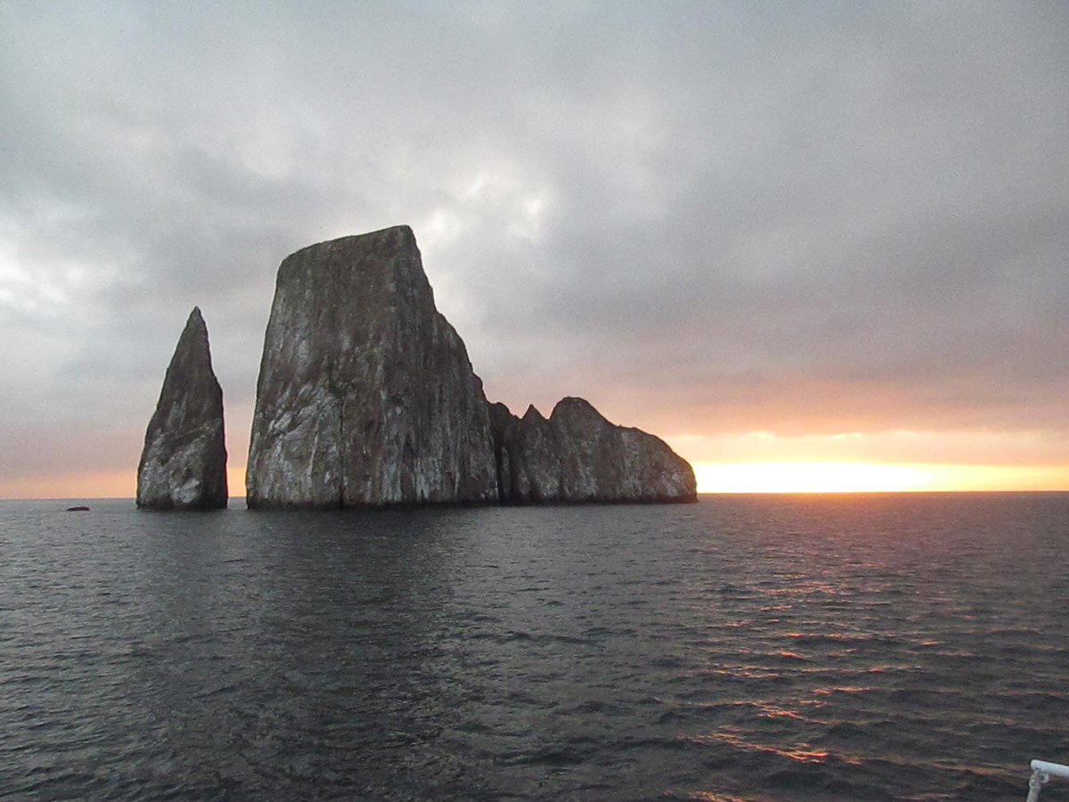
Kicker Rock, an iconic tall rock formation in the Galapagos known for its snorkeling amid rich marine life below.
For these many reasons, it would be a shame to overlook the Galapagos when considering travel. For any accomplished traveler, seeing the islands that inspired Charles Darwin to see the world in a whole new way — you may find it has the same effect on you.
Humankind has long built its societies strategically around avoiding the great strength and dynamism of volcanoes and shifting earth. And yet, these natural forces wielding powers of destruction are, as we’ve seen, incredibly generative. Some of the greatest ecological, geological, and zoological diversity are created and housed by the Mid-Ocean Ridge and its volcanic vents. And as this fascinating natural phenomena continues to alter the design of our planet, the natural beauty of earth continues to evolve. Mid-Ocean Ridges are just one awe-inspiring example of our planet’s long and complex evolution process.


